Blog · aral sea, Karakalpakstan
The Aral Sea disaster explained: what happened and how to see it today
How one of the largest lakes in the world almost disappeared in a few decades, why it happened, what it means for the people of Karakalpakstan, what is being done now, and how travellers can visit Muynak and the remaining sea responsibly.
The Aral Sea, once the fourth-largest lake in the world, shrank dramatically from the 1960s, after the Soviet Union diverted the Amu Darya and Syr Darya rivers to irrigate cotton. The southern part, in Uzbekistan, has mostly dried up, leaving a salty desert. Travellers can visit Muynak’s ship cemetery and, by 4x4, the remaining shore.
A sea in the desert
The Aral Sea lies between Kazakhstan in the north and Karakalpakstan, in Uzbekistan, in the south. It is a salt lake with no outlet to the ocean, fed by two great rivers: the Amu Darya from the Pamirs and the Syr Darya from the Tian Shan. Until the 1960s it covered roughly 68,000 square kilometres, making it the fourth-largest lake on Earth. It supported a large fishing industry, a fleet of boats and towns such as Muynak and Aralsk.
What happened
In the 1950s and 1960s, Soviet planners decided to turn Central Asia into a vast producer of cotton, "white gold". Huge irrigation canals, such as the Karakum Canal in Turkmenistan, took water from the Amu Darya and Syr Darya to irrigate millions of hectares of desert. Much of this water was lost through evaporation and leaky canals.
As less and less water reached the Aral, the sea began to shrink. By the 1980s, its level had fallen by many metres, the water had become much saltier, and most fish species had disappeared. The fishing industry collapsed. In the late 1980s, the sea split into a Northern (Small) Aral in Kazakhstan and a Southern (Large) Aral, which later divided into eastern and western basins. The eastern basin has dried almost completely in some years.
The consequences
The disappearance of the sea changed life in the region:
- Economy: fishing towns lost their livelihood; ports like Muynak were left far from the water.
- Climate: without the moderating effect of the sea, summers became hotter and drier and winters colder.
- Dust storms: winds now carry salt, sand and agricultural chemicals from the dry seabed, the new Aralkum desert, over hundreds of kilometres.
- Health: people in Karakalpakstan have suffered from high rates of respiratory diseases, anaemia and other health problems linked to poor water and dust.
- Nature: the wetlands of the Amu Darya delta shrank, and many species of birds and animals declined.
It is often described as one of the worst environmental disasters caused by humans.
Is the sea coming back?
In the north, Kazakhstan built the Kok-Aral dam in 2005, separating the Northern Aral and raising its level. Fish have returned, and fishing has partly revived there.
In the south, a full recovery is not expected, because the water of the Amu Darya is still needed for agriculture. Uzbekistan and international partners are working to reduce the damage: planting saxaul and other desert plants on the dry seabed to stabilise the soil and reduce dust storms, restoring small lakes and wetlands such as Sudochie Lake, improving water use and supporting the economy of Karakalpakstan. Muynak has received new investment, including a rebuilt airport.
Visiting Muynak
The town of Muynak, about 3–3.5 hours north of Nukus, is the most accessible place to understand the disaster. Below the town, rusting fishing boats lie on the old seabed in the ship cemetery, and a monument marks where the shore once was. The local museum shows photographs of the town in its prosperous days. See Nukus to Muynak.
Reaching the remaining sea
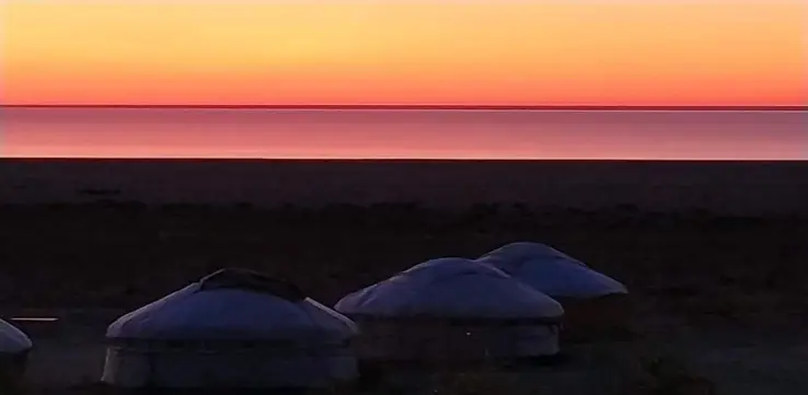
To see the water, you need a 4x4 with an experienced driver. From Muynak, the route crosses the dry seabed and the delta, often passing Sudochie Lake, then climbs onto the Ustyurt Plateau and follows its cliffs to the western basin of the Aral. A yurt camp near the shore offers dinner and a night under one of the darkest skies in Central Asia. The trip takes two or three days from Nukus. See our Aral Sea and Karakalpakstan tour.
The best seasons are late April to early June and September to early October.
Travelling responsibly
- Remember that people live in Muynak; be respectful when photographing them and their homes.
- Use local guides, drivers, guesthouses and cafés, so that tourism benefits the community.
- Leave nothing behind on the seabed or plateau.
- Combine the trip with the Savitsky Museum in Nukus and the desert fortresses, to see the richness of Karakalpakstan as well as its tragedy.
Why it matters
The Aral Sea is a warning about the cost of mismanaging water, a problem that many regions of the world face today. Standing among the ships of Muynak, looking at sand where fishermen once worked, is a powerful experience. For many visitors it is the most memorable and thought-provoking part of a trip to Uzbekistan. See also things to do in Nukus and Nukus weather.
A timeline
- 1950s–1960s: large-scale expansion of cotton irrigation in Soviet Central Asia.
- 1960s: the sea level begins to fall noticeably.
- 1980s: the fishing industry collapses; Muynak’s port is left far from the water.
- Late 1980s: the sea splits into the Northern and Southern Aral.
- 2005: the Kok-Aral dam in Kazakhstan helps the Northern Aral recover.
- 2010s: the eastern basin of the Southern Aral dries almost completely in some years.
- Today: saxaul planting, wetland restoration and investment in Karakalpakstan aim to reduce the damage.
Books and films
To learn more before your trip, look for documentaries and books about the Aral Sea and Karakalpakstan, and for the story of the Savitsky Museum in Nukus, told in the film The Desert of Forbidden Art. In Muynak, the local museum shows photographs and paintings of the town when it was still a fishing port.
Karakalpakstan beyond the disaster
The Aral Sea story is tragic, but Karakalpakstan is much more than a disaster zone. Its capital, Nukus, holds the extraordinary Savitsky Museum; its desert hides the ruined fortresses of ancient Khorezm, such as Toprak Kala and Ayaz Kala; and its people, the Karakalpaks, have a rich culture of epic songs, embroidery, silver jewellery and yurts. Spending a few days in the region, staying in local guesthouses and eating in local cafés, is the best way to understand both its past and its resilience today. See things to do in Nukus and the desert fortresses.
Frequently asked questions
Why did the Aral Sea dry up?
Because from the 1960s, the rivers that fed it were diverted to irrigate cotton and other crops in Central Asia.
Can you still see the Aral Sea?
Yes. The remaining western basin can be reached by 4x4 from Muynak or Nukus, usually with a night in a yurt camp.
Is the Aral Sea recovering?
The northern part in Kazakhstan has partly recovered thanks to a dam; the southern part is not expected to return, but work is being done to reduce dust and restore wetlands.